PROVISIONAL DATA SUBJECT TO REVISION
Click to hidestation-specific text
 Site Information
Summary of all available data for this site
Instantaneous-data availability statement


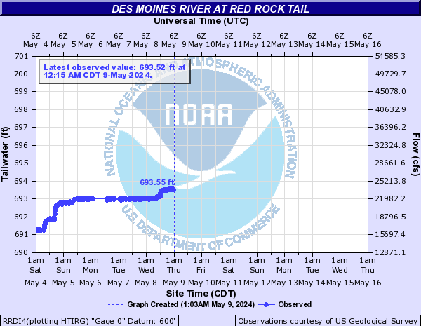
| Min (2025) | 25th percen- tile | Most Recent Instantaneous Value Feb 23 | Median | Mean | 75th percen- tile | Max (2016) |
|---|---|---|---|---|---|---|
| 392 | 1560 | 3150 | 3760 | 6110 | 7990 | 29700 |

![]() U.S. Department of the Interior |
U.S. Geological Survey
U.S. Department of the Interior |
U.S. Geological Survey
Title: USGS Current Conditions for the Nation
URL:
Page Contact Information: Iowa Water Data Support Team
Page Last Modified: 2026-02-23 14:31:15 EST
2.74 2.12 vaww01