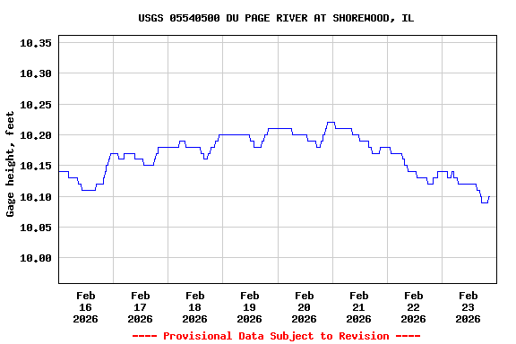
Most recent instantaneous value: 137 02-23-2026 20:45 CST

See this graph on the Monitoring Location Pages
| Min (1964) | Most Recent Instantaneous Value Feb 23 | 25th percen- tile | Median | Mean | 75th percen- tile | Max (1997) |
|---|---|---|---|---|---|---|
| 23.0 | 137 | 155 | 307 | 589 | 596 | 4830 |