PROVISIONAL DATA SUBJECT TO REVISION
Click to hidestation-specific text
Datum of gage was lowered 2.0 feet effective July 8, 2020 due to continued degradation (scour) of the channel at this streamgage. Previous datum at this gage was 2,800.18 ft above NAVD88, and is now 2,798.18 ft above NAVD88. Please contact Jason Lambrecht (jmlambre@usgs.gov, 402-328-4124) or John Miller (jdmiller@usgs.gov, 308-532-5323) at the USGS Nebraska Water Science Center with any questions.
| Funding for this site is provided by |
|
|
|
National Streamflow Information Program |
 WaterNow – get the latest
gage data from your mobile phone or email.
WaterNow – get the latest
gage data from your mobile phone or email.
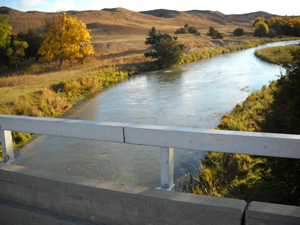
Downstream view from USGS gaging station: Dismal River near Thedford, Nebr.
|
|
Loup River Basin |
|
Summary of all available data for this site
Instantaneous-data availability statement


