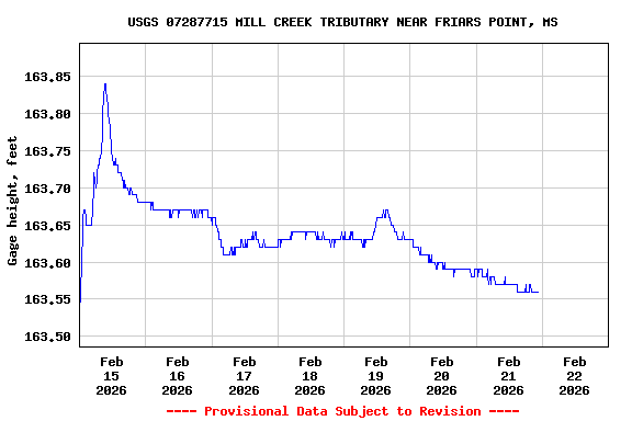
Most recent instantaneous value: 163.56 02-21-2026 22:30 CST
See this graph on the Monitoring Location Pages
Discharge, cubic feet per second |
||
|
||
![]() U.S. Department of the Interior |
U.S. Geological Survey
U.S. Department of the Interior |
U.S. Geological Survey
Title: USGS Current Conditions for the Nation
URL:
Page Contact Information: Mississippi Water Data Support Team
Page Last Modified: 2026-02-22 00:05:17 EST
1.2 0.92 caww01