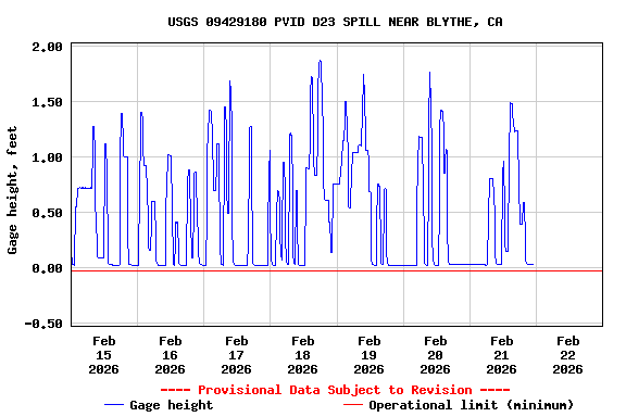
Most recent instantaneous value: 0.16 02-21-2026 22:45 MST
See this graph on the Monitoring Location Pages
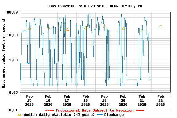
| Most Recent Instantaneous Value Feb 22 | Min (1981) | 25th percen- tile | Median | Mean | 75th percen- tile | Max (1982) |
|---|---|---|---|---|---|---|
| 0.16 | 0.20 | 14 | 22 | 23 | 31 | 60.6 |