PROVISIONAL DATA SUBJECT TO REVISION
Click to hidestation-specific text
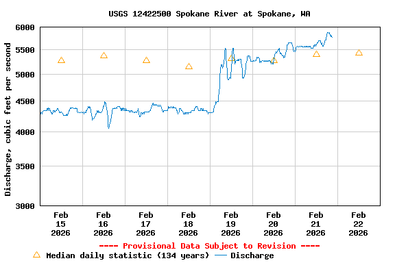
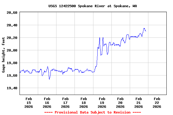
Additional Data and Information.-- Latest shifted rating.
Flood Stage.--The National Weather Service Flood Stage for this station is 27.0 feet.
Funding for this site is provided by the cooperators / programs below:
This is the oldest continuously
operating USGS
gage in Washington State; it has been in operation since April
1891.
Summary of all available data for this site
Instantaneous-data availability statement