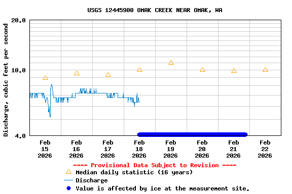
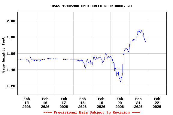
PROVISIONAL DATA SUBJECT TO REVISION
Click to hidestation-specific text
Flood Stage.--The National Weather Service has not established a Flood Stage for this station.
Funding for this site is provided by the cooperators / programs below:
- Bonneville Power Administration through the Colville Confederated Tribes' Okanogan Basin Monitoring and Evaluation Program
Summary of all available data for this site
Instantaneous-data availability statement