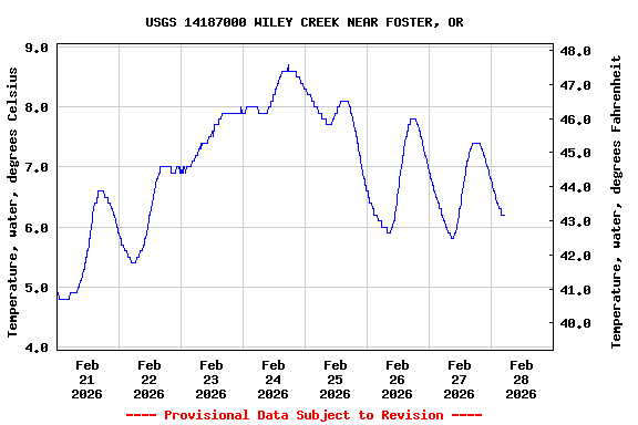
Most recent instantaneous value: 6.3 02-28-2026 03:10 PST
See this graph on the Monitoring Location Pages
Station operated in cooperation with the U.S. Army Corps of Engineers.
NOTE: The most current shifted rating for this site can be found at USGS Rating Depot website.
| Boating safety tips |

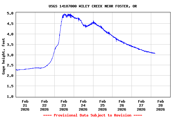
| Min (2001) | 25th percen- tile | Median | Mean | 75th percen- tile | Most Recent Instantaneous Value Feb 28 | Max (1999) |
|---|---|---|---|---|---|---|
| 61.0 | 147 | 230 | 292 | 330 | 361 | 1660 |
![]() U.S. Department of the Interior |
U.S. Geological Survey
U.S. Department of the Interior |
U.S. Geological Survey
Title: USGS Current Conditions for the Nation
URL:
Page Contact Information: Oregon Water Data Support Team
Page Last Modified: 2026-02-28 06:27:09 EST
2.8 2.17 vaww01