PROVISIONAL DATA SUBJECT TO REVISION
Click to hidestation-specific text
Additional Data and Information.-- Latest shifted rating.
Flood Stage.--The National Weather Service Flood Flow for this station is 25,000 cfs.
Funding for this site is provided by the cooperators / programs below:
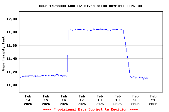
This station is 1.4 miles below
Mayfield Reservoir, photo of reach below dam to gage. The flow
can change quickly from releases. Please use caution in or on the
river.
Summary of all available data for this site
Instantaneous-data availability statement