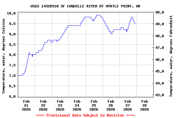
Most recent instantaneous value: 9.5 02-27-2026 22:20 PST
See this graph on the Monitoring Location Pages
Station operated in cooperation with Coos County.
Station funded by U.S. Geological Survey National Streamflow
Information Program (NSIP).
| Boating safety tips |
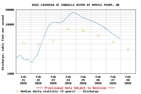
| Min (2024) | Mean | Median | Max (2025) | Most Recent Instantaneous Value Feb 28 |
|---|---|---|---|---|
| 2360 | 3200 | 3200 | 4030 | 5100 |
![]() U.S. Department of the Interior |
U.S. Geological Survey
U.S. Department of the Interior |
U.S. Geological Survey
Title: USGS Current Conditions for the Nation
URL:
Page Contact Information: Oregon Water Data Support Team
Page Last Modified: 2026-02-28 01:59:34 EST
4.87 4.09 sdww01