PROVISIONAL DATA SUBJECT TO REVISION
Click to hidestation-specific text
Funding for this site is provided by:
 Rating Information
Summary of all available data for this site
Instantaneous-data availability statement
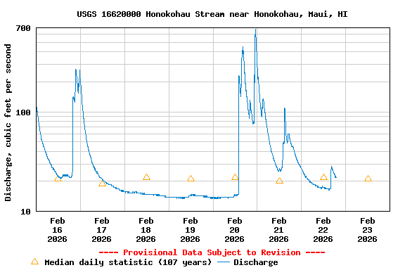
| Min (1963) | 25th percen- tile | Median | Most Recent Instantaneous Value Feb 23 | Mean | 75th percen- tile | Max (1930) |
|---|---|---|---|---|---|---|
| 9.10 | 16 | 21 | 22.0 | 31 | 32 | 217 |
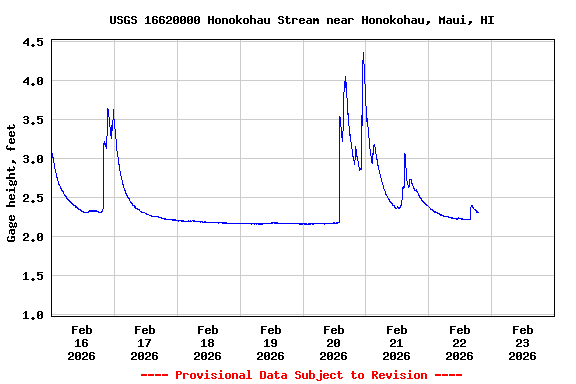
Gage height, feet, [Backup] |
||
|
||
![]() U.S. Department of the Interior |
U.S. Geological Survey
U.S. Department of the Interior |
U.S. Geological Survey
Title: USGS Current Conditions for the Nation
URL:
Page Contact Information: Hawaii Water Data Support Team
Page Last Modified: 2026-02-23 00:50:30 EST
3.87 3.24 sdww02