PROVISIONAL DATA SUBJECT TO REVISION
Click to hidestation-specific text
Funding for this site is provided by:
 STATION.--402750078452201 CAMBRIA COUNTY, local well
number CA 462.
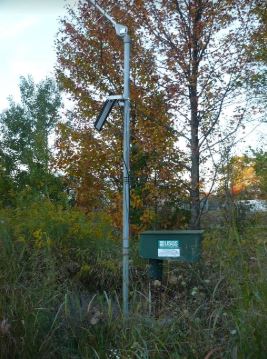
STATION.--402750078452201 CAMBRIA COUNTY, local well
number CA 462.LOCATION.--Lat 40`27'45.3", long 78`45'32.6", Hydrologic Unit 05010007, near Ebensburg.
OWNER.--Commonwealth of Pennsylvania.
AQUIFER.--Pennsylvanian aquifers, Glenshaw Formation.
WELL CHARACTERISTICS.--Drilled unused observation well, diameter 6 in., depth 142 ft, cased to 17 ft, open hole.
INSTRUMENTATION.--Data collection platform with 60-minute recording interval. Satellite telemetry at station.
DATUM.--Elevation of land surface is 2,135 ft above North American Vertical Datum of 1988, from Lidar. Measuring point: Top of casing above concrete pad, 2.90 ft above land-surface datum, Feb. 28, 2008 to present
PERIOD OF RECORD.--June 2008 to current year.
COOPERATION.--Funding for the operation of this station is provided by the Pennsylvania Department of Environmental Protection and the U.S. Geological Survey.
Summary of all available data for this site
Instantaneous-data availability statement
