PROVISIONAL DATA SUBJECT TO REVISION
Click to hidestation-specific text
Funding for this site is provided by:
 STATION.--03017500 TIONESTA CREEK AT LYNCH,
PA.
STATION.--03017500 TIONESTA CREEK AT LYNCH,
PA.LOCATION.--Lat 41`36'07", long 79`03'01", referenced to North American Datum of 1927, Forest County, Hydrologic Unit 05010003.
DRAINAGE AREA.--233 square miles.
PERIOD OF RECORD.--1938-1979, 1981 and 1988-2010 (discharge measurements only), 2011 to current year. Monthly discharge only for some periods, published in WSP 1305.
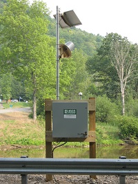
GAGE.--Water-stage recorder. Datum of gage is 1,252.0 ft above North American Vertical Datum of 1988. Prior to November 16, 2022, the datum of gage was reported as 1,252.43 ft above National Geodetic Vertical Datum of 1929. Satellite telemetry at site.
COOPERATION.--Station established and maintained by the U.S. Geological Survey. Funding for the operation of this station is provided by the U.S. Army Corps of Engineers, Pittsburgh District.
Instantaneous-data availability statement


