LOCATION.--Lat 41°49'50", long 95°55'52"
referenced to North American Datum of 1927, in NE 1/4 SW 1/4 NE 1/4
sec.14, T.81 N., R.44 W., Harrison County, IA, Hydrologic Unit
10230001, on right bank on upstream side of bridge on County Highway
F20, at western edge of Pisgah, 0.4 mi downstream from Cobb Creek,
0.4 mi upstream from Mogger Ditch, and 12.3 mi upstream from mouth.
(map)
DRAINAGE AREA.--407 mi2.
SURFACE-WATER RECORDS
PERIOD OF RECORD.--Discharge records from March 1940 to current
year.
REVISED RECORDS.--WSP 956: 1940 (M). WSP 1240: 1940, 1941 (M),
1947. WSP 1440: Drainage area.
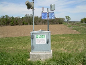
GAGE.--Water-stage recorder. Datum of gage is 1,036.53 ft above
National Geodetic Vertical Datum of 1929. Prior to February 1, 1954,
non-recording gage at site 75 ft upstream at same datum, with
supplementary water-stage recorder operating above 8.2 ft gage height
from March 2, 1946, to September 24, 1953; February 1, 1954, to
October 10, 1954, non-recording gage, and October 11, 1954, to June
21, 1989, water-stage recorder, both at site 25 ft downstream at same
datum; June 22, 1989, to August 12, 2010, water-stage recorder at
site 75 ft upstream at same datum.
WATER-QUALITY RECORDS
PERIOD OF DAILY RECORD.--
SUSPENDED-SEDIMENT DISCHARGE: March 1940 to September 1951, records
provided by U.S. Army Corps of Engineers.
 Site Information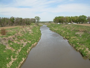
 Advanced
Hydrologic Prediction Service
Advanced
Hydrologic Prediction Service






 U.S. Department of the Interior |
U.S. Geological Survey
U.S. Department of the Interior |
U.S. Geological Survey