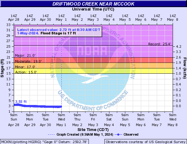
PROVISIONAL DATA SUBJECT TO REVISION
Click to hidestation-specific text
 WaterNow – get the latest
gage data from your mobile phone or email.
WaterNow – get the latest
gage data from your mobile phone or email.
Summary of all available data for this site
Instantaneous-data availability statement

| Min (1955) | Most Recent Instantaneous Value Aug 1 | 25th percen- tile | Median | 75th percen- tile | Mean | Max (1941) |
|---|---|---|---|---|---|---|
| 0.00 | 0.20 | 0.32 | 1.5 | 23 | 30 | 305 |

![]() U.S. Department of the Interior |
U.S. Geological Survey
U.S. Department of the Interior |
U.S. Geological Survey
Title: USGS Current Conditions for the Nation
URL:
Page Contact Information: Nebraska Water Data Support Team
Page Last Modified: 2026-08-01 12:38:15 EDT
1.29 0.98 caww02