PROVISIONAL DATA SUBJECT TO REVISION
Click to hidestation-specific text
This station is operated by the USGS and funded by the
 U.S. Army Corps of Engineers, Kansas
City District.
U.S. Army Corps of Engineers, Kansas
City District.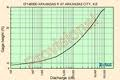 Current
shift-adjusted rating in tab-separated format. What is a
shift-adjusted rating?
Current
shift-adjusted rating in tab-separated format. What is a
shift-adjusted rating?
 Subscribe to USGS WaterAlert to receive push
notifications when specific conditions occur at this site.
Subscribe to USGS WaterAlert to receive push
notifications when specific conditions occur at this site. Visit
USGS Real-Time Water Quality to view continuous estimates of
concentrations and loads for bacteria and other
chemicals.
Visit
USGS Real-Time Water Quality to view continuous estimates of
concentrations and loads for bacteria and other
chemicals.Summary of all available data for this site
Instantaneous-data availability statement


