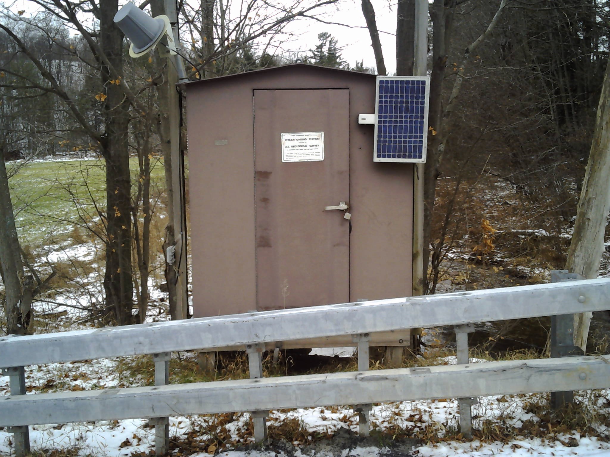
LOCATION.--Lat 42°21'40", long
74°39'44" referenced to North American Datum of 1983,
Delaware County, NY, Hydrologic Unit 02040101, on left bank 10
ft downstream from bridge on Clove Road, 0.9 mi southeast of
Hobart, and 1.4 mi upstream from mouth.
DRAINAGE AREA.--14.3 mi².
PERIOD OF RECORD.--October 1997 to current year.
GAGE.--Water-stage recorder and crest-stage gage. Datum
of gage is 1,658.43 ft above NAVD of 1988.
REMARKS.--Water Years 2014-23: Records fair except those
for estimated daily discharges, which are poor.
EXTREMES FOR PERIOD OF RECORD.--Maximum discharge, 4,400
ft³/s, July 4, 1999, gage height, 7.54 ft, from rating curve
extended above 860 ft³/s on basis of contracted-opening and
flow-over-road measurement of peak flow; minimum discharge,
0.25 ft³/s, Sept. 13, 14, 2005; minimum gage height, 0.18 ft,
Sept. 5, 1999.
EXTREMES OUTSIDE PERIOD OF RECORD.--Maximum discharge,
3,100 ft³/s, Jan. 19, 1996, gage height, 7.42 ft, from
floodmark, from rating curve extended as explained above.

 Site Information
 WaterAlert – get an
email or text (SMS) alert based on your chosen threshold.
WaterAlert – get an
email or text (SMS) alert based on your chosen threshold.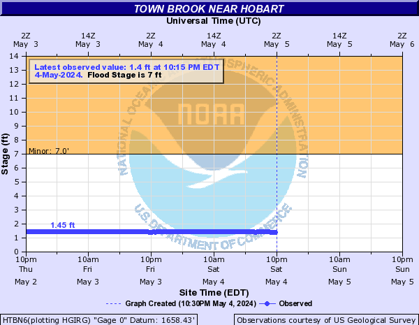
 Station image