Most recent instantaneous value: 2240 05-21-2026 00:00 PDT
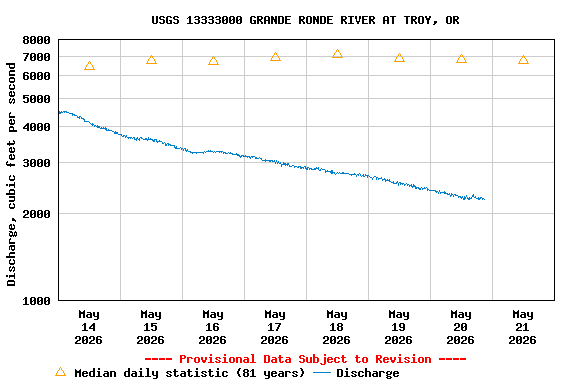
See this graph on the Monitoring Location Pages
| Min (1977) | Most Recent Instantaneous Value May 21 | 25th percen- tile | Median | Mean | 75th percen- tile | Max (1948) |
|---|---|---|---|---|---|---|
| 2170 | 2240 | 5090 | 6750 | 7720 | 9870 | 17400 |