Funding for this site is provided by:
 STATION.
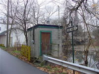
--03015500 BROKENSTRAW CREEK AT YOUNGSVILLE,
PA
LOCATION.--Lat 41`51'09", long
79`19'03", Warren County, Hydrologic Unit 05010001, on right
bank 150 ft downstream from bridge on Main Street at Youngsville, 500
ft upstream from Matthews Run, and 3.7 mi upstream from mouth. Records
include flow of Matthews Run.
DRAINAGE AREA.--321 square miles, including that of
Matthews Run.
PERIOD OF RECORD.--October 1909 to current year.
Monthly discharge only for some periods, published in WSP 1305. Flow of
Matthews Run included in records since October 1938.
GAGE.--Water-stage recorder and non-heated tipping
bucket precipitation gage. Datum of gage is 1,186.3 ft above North
American Vertical Datum of 1988. Prior to Sept. 30, 1933, nonrecording
gage at site 150 ft upstream at datum 2.00 ft higher. Oct. 1, 1933 to
June 15, 1939, nonrecording gage at site 150 ft upstream, and June 16,
1939 to Sept. 30, 1961, water-stage recorder at present site, both at
datum 1.00 ft higher. Satellite telemetry at station. Prior to November
10, 2022, the datum of gage was reported as 1,186.92 ft above National
Geodetic Vertical Datum of 1929.
COOPERATION.---Station established and maintained by
the U.S. Geological Survey. Funding for the operation of this station
is provided by the U.S. Army Corps of Engineers, Pittsburgh District,
the Pennsylvania Department of Environmental Protection, and the U.S.
Geological Survey.
REMARKS.--
| The 15-minute precipitation data for this station are
temporary and will only be displayed for 120 days. Time series
of 1-hour or cumulative daily values will NOT be available for
retrieval following the 120-day display period. Although the
instrumentation is calibrated at least once a year, the temporary
classification means that documented routine inspections and other
quality assurance measures are not performed that would make the
data acceptable for archival, retrieval, or future use in general
scientific or interpretive studies. |

![[!]](https://pa.water.usgs.gov/images/exclaim.gif) Over the
next year, the USGS Pennsylvania Water Science Center will be updating
the geodetic vertical elevation (gage datum) for many locations. Click
HERE for additional information including a current list of
streamgages with upcoming datum changes. This update in gage datum does
not affect the location of the streamgage, nor the observed local gage
height or discharge recorded at the streamgage.
Over the
next year, the USGS Pennsylvania Water Science Center will be updating
the geodetic vertical elevation (gage datum) for many locations. Click
HERE for additional information including a current list of
streamgages with upcoming datum changes. This update in gage datum does
not affect the location of the streamgage, nor the observed local gage
height or discharge recorded at the streamgage.