PROVISIONAL DATA SUBJECT TO REVISION
Click to hidestation-specific text
Funding for this site is provided by:
DRAINAGE AREA.--91 mi².
PERIOD OF RECORD.--December 1986 to September 1992; October 2001 to current year.
REVISIONS HISTORY.--WDR PA-02-1: 1988-92 (P).
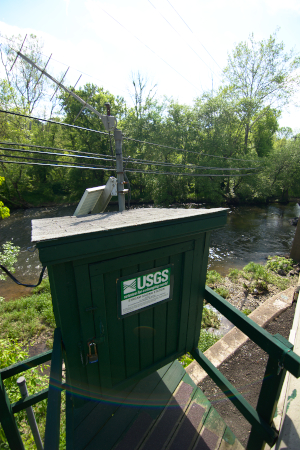
GAGE.--Water-stage recorder and crest-stage gage. Elevation of gage is 160 ft above National Geodetic Vertical Datum of 1929, from topographic map. Satellite and landline telemetry at station.
COOPERATION.--Station established and maintained by the U.S. Geological Survey. Funding for the operation of this station is provided by the Bucks County Commissioners and the U.S. Geological Survey.
REMARKS.--Flow regulated by Lake Galena (Peace Valley Reservoir) and diversion for municipal supply by Forest Park Water Company from North Branch Neshaminy Creek.
Summary of all available data for this site
Instantaneous-data availability statement
