PROVISIONAL DATA SUBJECT TO REVISION
Click to hidestation-specific text
Funding for this site is provided by:
 STATION.--401733075171401 MONTGOMERY COUNTY, local
well number MG917
STATION.--401733075171401 MONTGOMERY COUNTY, local
well number MG917LOCATION.--Lat 40 17'33.8", long 75 17'12.0", Hydrologic Unit 02040201, at North Penn Water Authority at Lansdale.
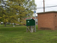
OWNER.--North Penn Water Authority.
AQUIFER.--Shale of Brunswick Formation of Late Triassic Age.
WELL CHARACTERISTICS.--Drilled observation well, diameter 8 in, depth 500 ft, cased to 40 ft, open hole.
INSTRUMENTATION.--Data collection platform with 15-minute recording interval since April 2023; prior, 60-minute recording interval. Satellite telemetry at station.
DATUM.--Elevation of land surface is 350 ft above sea level, from topographic map. Measuring point: Top of plywood shelf, 3.39 ft above land-surface datum.
REMARKS.--Daily maximum, minimum, and mean water levels are available from the District Office.
PERIOD OF RECORD.--August 1997 to current year.
COOPERATION.--Funding for the operation of this station is provided by the Pennsylvania Department of Environmental Protection and the U.S. Geological Survey.
Summary of all available data for this site
Instantaneous-data availability statement
