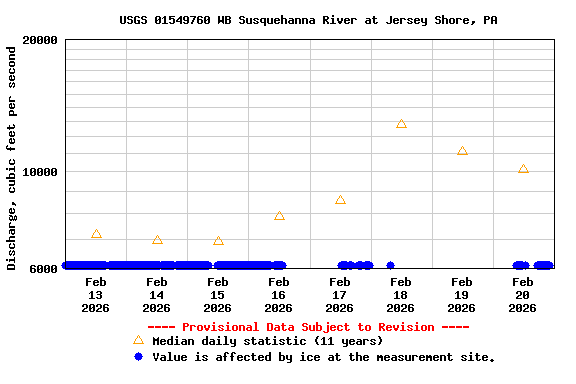
PROVISIONAL DATA SUBJECT TO REVISION
Click to hidestation-specific text
Funding for this site is provided by:
Interactive Flood Inundation Map Available
 STATION.--01549760 WEST BRANCH SUSQUEHANNA RIVER AT
JERSEY SHORE, PA
STATION.--01549760 WEST BRANCH SUSQUEHANNA RIVER AT
JERSEY SHORE, PALOCATION.--Lat 41 12'08", long 077 15'05", Lycoming County, Hydrologic Unit 02050206, on right bank of left river channel at SR44 bridge in Jersey Shore.
DRAINAGE AREA.--5,225 square miles.
PERIOD OF RECORD.--October 26, 1938 staff gage. National Weather Service wire-weight gage installed October 4, 1946. Recording equipment installed March 23, 2000 for operation as a stage-only gage. Continuous record-annual peak site Oct 1, 2004- Sept 30, 2014. Continuous record discharge site from Oct 1, 2014 to current.
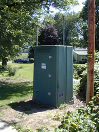
GAGE.--Water-stage recorder and crest-stage gage. Datum of gage is 512.54 ft above North American Vertical Datum of 1988. Prior to March 14, 2024, the datum of gage was reported as 513.19 ft above National Geodetic Vertical Datum of 1929. Satellite telemetry at station.
COOPERATION.--Station established and maintained by the U.S. Geological Survey. Funding for the operation of this station is provided by the U.S. Geological Survey.
REMARKS.--Daily discharge not available from Oct 1, 2004 through Sept 30, 2014.
GAGE HEIGHTS OF IMPORTANCE.-
Supplied by USGS: Data transmitter operational limit - 36.4 ft;
Supplied by NWS: Action stage-23 ft, Long Island (Rt 44) and North Main Street in Jersey Shore may be closed to traffic; Flood stage-26 ft, river overflows onto Long Island; Moderate flood stage-28 ft, the left, or north bank overflows; some homes adjacent to the river are affected; Major flood stage-29 ft, many homes and businesses in Jersey Shore are affected by high water.
Summary of all available data for this site
Instantaneous-data availability statement


