USGS 50045010 RIO DE LA PLATA BLW LA PLATA DAMSITE, PR

PROVISIONAL DATA SUBJECT TO REVISION

Click to hidestation-specific text
Click to go to the Autoridad de Acueductos y Alcantarillados de Puerto Rico web page

Station Drainage Area


Image of Rio de La Plata below La Plata Dam
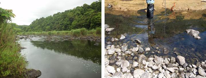
Photos by USGS, Caribbean-Florida Water Science Center Hydrologic Technicians - San Juan.
This station managed by the Caribbean-Florida WSC - San Juan.

Available Parameters Available Period
  
1990-10-02  2026-02-24
2007-10-01  2026-02-24
2007-10-01  2026-02-24


 (7)
 

  -- or --


Summary of all available data for this site
Instantaneous-data availability statement


Discharge, cubic feet per second

Most recent instantaneous value: 0.33 02-24-2026   16:15 AST
Graph of  Discharge, cubic feet per second

Add up to 2 more sites and replot for "Discharge, cubic feet per second"

?


Create presentation-quality / stand-alone graph.   Subscribe to WaterAlert      

See this graph on the Monitoring Location Pages


Daily discharge, cubic feet per second -- statistics for Feb 24 based on 36 water years of record more
Min
(1995)
Most Recent
Instantaneous
Value Feb 24
25th
percen-
tile
Median 75th
percen-
tile
Mean Max
(2018)
0.00 0.33 0.35 1.2 3 20 203


Gage height, feet

Most recent instantaneous value: 6.88 02-24-2026   16:15 AST
Graph of  Gage height, feet

Add up to 2 more sites and replot for "Gage height, feet"

?


Create presentation-quality / stand-alone graph.   Subscribe to WaterAlert      

See this graph on the Monitoring Location Pages


Stream water level elevation, above Puerto Rico Datum of 2002, feet

Most recent instantaneous value: 46.71 02-24-2026   16:15 AST
Graph of  Stream water level elevation, above Puerto Rico Datum of 2002, feet

Add up to 2 more sites and replot for "Stream water level elevation, above Puerto Rico Datum of 2002, feet"

?


Create presentation-quality / stand-alone graph.   Subscribe to WaterAlert      

See this graph on the Monitoring Location Pages