PROVISIONAL DATA SUBJECT TO REVISION
Click to hidestation-specific text
| Funding for this site is provided by the cooperators / programs below: | |
|
Edwards Aquifer Authority |
Cooperative Matching Funds |
|
|
|
| Rainfall Disclaimer | |
|
|
|
|
Retransmission, forecasts and summary by the National Weather Service |
|
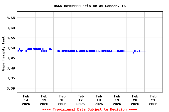
The elevation of this station has been determined to be 1203.54 feet above NAVD 1988. To obtain stream water-surface elevation values in NAVD 1988 add 1203.54 feet to gage height values.
Summary of all available data for this site
Instantaneous-data availability statement