PROVISIONAL DATA SUBJECT TO REVISION
Click to hidestation-specific text
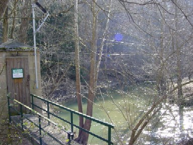
LOCATION.--Lat 39°36'14.7", long 76°37'13.7", Baltimore County, MD, Hydrologic Unit 02060003, on left bank
   at downstream side of Pennsylvania Railroad bridge (converted to the North Central-Gunpowder Falls State Park Trail),
   0.2 mi north of Blue Mount, 0.6 mi upstream from mouth, 0.9 mi downstream from First Mine Branch, and 1.2 mi south of
   White Hall.
DRAINAGE AREA.--52.9 mi2.
PERIOD OF RECORD.--June 1944 to current year.
REVISIONS HISTORY.--WSP 111: 1944(M), 1945-47(P). WDR MD-DE-85-1: 1984(P).
GAGE.--Water-stage recorder and crest-stage gage. Datum of gage is 302.32 ft above North American Vertical Datum of 1988.
REMARKS.--U.S. Geological Survey satellite data-collection platform at station.
EXTREMES FOR PERIOD OF RECORD.--Maximum discharge, 8,280 ft³/s, June 22, 1972, gage height 18.54 ft;
   minimum discharge, 1.9 ft³/s, August 29, 1966.
COOPERATION.--Funding for the operation of this station is provided by the Baltimore City Department of Public Works,
   and the U.S. Geological Survey.
| Boating safety tips |
Summary of all available data for this site
Instantaneous-data availability statement

