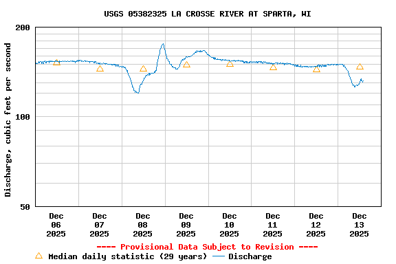
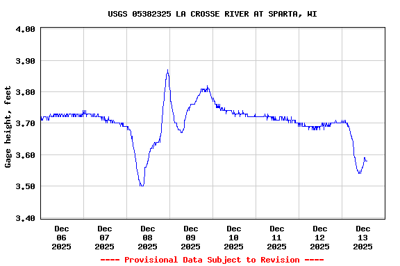
PROVISIONAL DATA SUBJECT TO REVISION
LOCATION.--Lat 43°56'15", long 90°48'38", in SE 1/4 NE 1/4 sec.23, T.17 N., R.4 W., Monroe County, Hydrologic Unit 07040006, on left bank, 800 ft downstream from bridge on South Water Street, in Sparta, 0.35 mi downstream from Beaver Creek.
DRAINAGE AREA.--167 square miles.
PERIOD OF RECORD.--July 1992 to October 2005 and October 2008 to present.
GAGE.--Water-stage recorder and crest-stage gage. Datum of gage is 760.66 ft above NAVD 1988.
REMARKS.--Gage-height telemeter at station. Occasional regulation from two dams upstream from gage.
Operated with funding from the U.S.
Geological Survey
National Streamflow Information Program
![]()
| Boating safety tips |
Summary of all available data for this site
Instantaneous-data availability statement

