Most recent instantaneous value: 123 05-20-2026 20:45 MDT
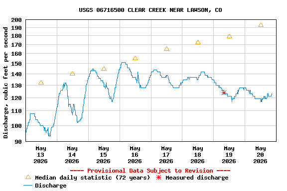
See this graph on the Monitoring Location Pages
| Min (1981) | Most Recent Instantaneous Value May 20 | 25th percen- tile | Median | Mean | 75th percen- tile | Max (2007) |
|---|---|---|---|---|---|---|
| 56.0 | 123 | 149 | 193 | 227 | 285 | 634 |