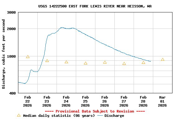
PROVISIONAL DATA SUBJECT TO REVISION
Click to hidestation-specific text
Put your HTML text here

Station Notes
The datum of the gage has been determined to be 357.84 ft above
NAVD 1988. To obtain stream water-surface elevation values in NAVD
1988, add 357.84 ft to gage height values.
Additional Data and Information.-- Latest shifted rating.
Flood Stage.--The National Weather Service has not established a Flood Stage for this station.
Funding for this site is provided by the cooperators / programs below:
Summary of all available data for this site
Instantaneous-data availability statement