PROVISIONAL DATA SUBJECT TO REVISION
Click to hidestation-specific text
Additional Data and Information.-- Latest shifted rating.
Flood Stage.--The National Weather Service Flood Stage for this station is 211.5 feet. Thurston County has Flood Information for this gage.
Funding for this site is provided by the cooperators / programs below:
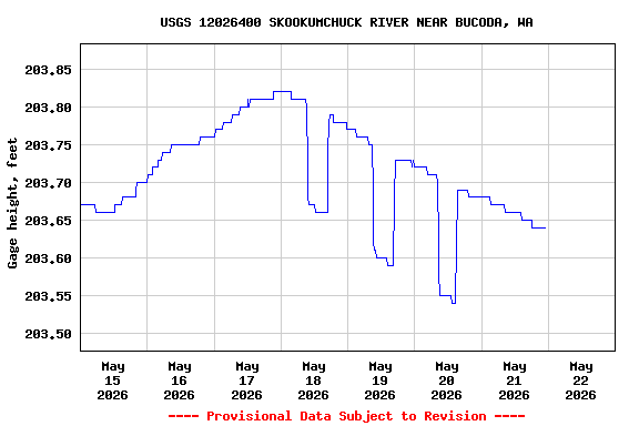
Gage height datum conversion
to the NAVD88 datum for this streamgage was completed on May 3,
2018. All reported gage heights and those associated with
discharge measurements and stage-discharge ratings have been
converted and are consistent with elevations based on the NAVD88
datum. A conversion factor of 198.15 ft was used to convert the
old gage heights to the currently reported instantaneous gage
height, discharge measurement gage heights, and stage-discharge
rating points.
Summary of all available data for this site
Instantaneous-data availability statement