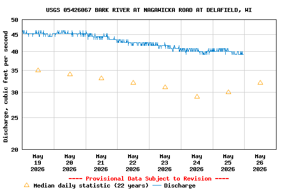
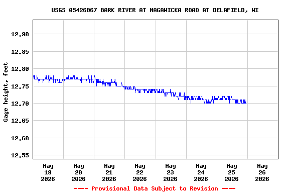
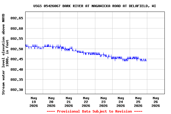
PROVISIONAL DATA SUBJECT TO REVISION
Click to hidestation-specific text
LOCATION.-- Lat 43°05'16", long 88°22'34" in NE 1/4 NW 1/4 sec.9, T.7 N., R.18 E., Waukesha County, WI, Hydrologic Unit 07090001, on left bank 20 ft upstream from Nagawicka Road in Delafield.
DRAINAGE AREA.-- 35.9 sq. mi.
PERIOD OF RECORD.-- October 2002 to present.
GAGE.--Water stage recorder. Elevation of gage is 879.74 ft +/- 0.05 ft NAVD88.
REMARKS.--Gage-height telemeter at station.
Operated in Cooperation With:


| Boating safety tips |
Summary of all available data for this site
Instantaneous-data availability statement