PROVISIONAL DATA SUBJECT TO REVISION
Click to hidestation-specific text

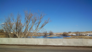
Downstream view from USGS gaging station: Lodgepole Creek at Bushnell, Nebr.
Summary of all available data for this site
Instantaneous-data availability statement

Downstream view from USGS gaging station: Lodgepole Creek at Bushnell, Nebr.

| Min (2007) | Most Recent Instantaneous Value Apr 23 | 25th percen- tile | Mean | Median | 75th percen- tile | Max (1984) |
|---|---|---|---|---|---|---|
| 0.00 | 2.69 | 3.6 | 8.5 | 9.6 | 13 | 23.9 |
