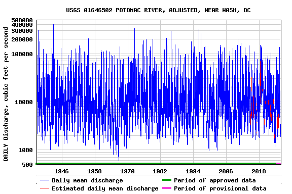
LOCATION.--Lat 38°56'59.2", long 77°07'39.5", Montgomery County, MD, Hydrologic Unit 02070008,
   on left bank just upstream from Little Falls Dam, 1 mi upstream from District of Columbia boundary
   line, 1.2 mi upstream from Chain Bridge, 1.8 mi east of Langley, Fairfax County, and at mile 117.4.
PERIOD OF RECORD.--March 1930 to current year.
GAGE.--Record includes computed discharge at 01646500 POTOMAC RIVER NEAR WASHINGTON, DC along with
   furnished records of diversions. Datum of gage is 37.20 ft above North American Vertical Datum
   of 1988.
REMARKS.--Adjusted records include diversions for municipal supply of Washington, D.C.,
   Washington Suburban Sanitary District, city of Rockville, city of Fairfax (from Goose Creek),
   Fairfax County, and the Chesapeake and Ohio Canal. Furnished records provided by U.S. Army Corps of
   Engineers, Washington Suburban Sanitary Commission, city of Rockville, Loudoun Water, and Fairfax
   County Water Authority.
