Most recent instantaneous value: 69.0 02-24-2026 14:15 MST
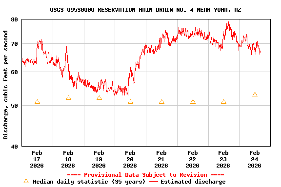
See this graph on the Monitoring Location Pages
| Min (2014) | 25th percen- tile | Median | Mean | 75th percen- tile | Most Recent Instantaneous Value Feb 24 | Max (1995) |
|---|---|---|---|---|---|---|
| 36.7 | 47 | 53 | 55 | 61 | 69.0 | 80.0 |