LOCATION.--Lat 39°28'46.1", long 76°40'40.9", Baltimore County, MD, Hydrologic Unit 02060003,
on right bank at upstream side of bridge on Ivy Hill Road, 0.3 mi upstream from mouth, 0.6 mi
southwest of Broadmoor, and 1.8 mi west of Cockeysville.
DRAINAGE AREA.--1.47 mi2.
PERIOD OF RECORD.--August 1964 to September 1969, annual maximums, water years 1970-76, November 1999 to
current year.
REVISIONS HISTORY.--
WDR-US-2012: 2007(P), 2011(P).
https://waterdata.usgs.gov/nwis/dv/?site_no=01583580: 2020.
GAGE.--Water-stage recorder, crest-stage gage and sharp-crested weir plate. Datum of gage is 329.33 ft above
North American Vertical Datum of 1988.
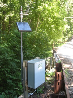
REMARKS.--U.S. Geological Survey satellite data-collection platform at station.
EXTREMES FOR PERIOD OF RECORD.--Maximum discharge, 692 ft3/s, June 22, 1972, gage height, 6.08 ft;
minimum discharge, 0 ft3/s, no flow, Aug. 27 to Sept. 13, 1966, July 23, 30, 31, Aug. 1-3, 7-24, 2002.
COOPERATION.--Funding for the operation of this station is provided by the Baltimore County Department
of Environmental Protection & Sustainability and the U.S. Geological Survey.
