LOCATION.--Lat 43°16'38.59", long
76°58'26.37" referenced to North American Datum of
1983, Wayne County, NY, Hydrologic Unit 04150200, at U. S.
Coast Guard Sodus Outer Lighthouse tower on north end of west
pier, entrance to Great Sodus Bay, 1.4 mi northeast of Sodus
Point.
PERIOD OF RECORD.--July 2017 to current
year.
GAGE.--Water-stage recorder. Datum of gage is IGLD of
1985. Prior to Oct. 16, 2019, at site 0.3 mi south at U.S.
Coast Guard boat dock on south end of west pier, entrance to
Great Sodus Bay.
EXTREMES FOR PERIOD OF RECORD.--Maximum elevation,
249.00 ft, June 6, 2019; minimum elevation, 243.51 ft, Nov. 17,
2024.
EXTREMES OUTSIDE PERIOD OF RECORD.--Flood in May 2017,
reached an elevation of 248.84 ft, present datum, from
floodmarks.
 Site Information
 WaterAlert – get an
email or text (SMS) alert based on your chosen threshold.
WaterAlert – get an
email or text (SMS) alert based on your chosen threshold.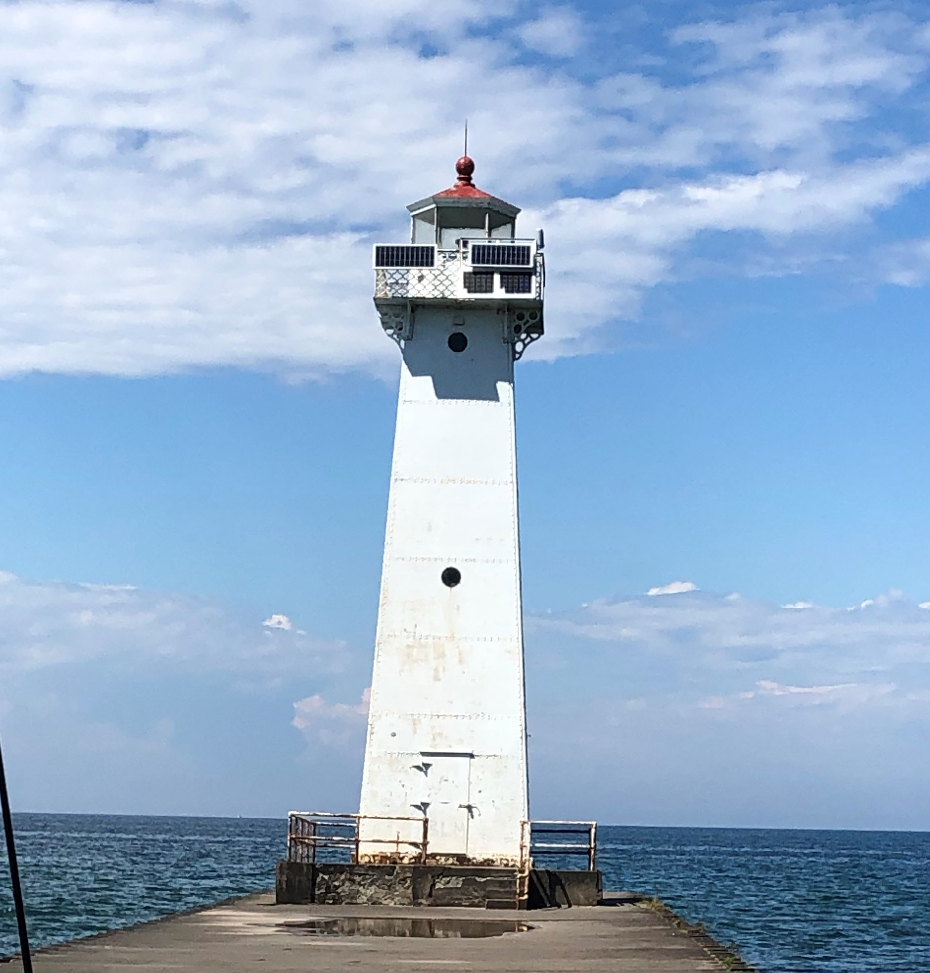 Station image