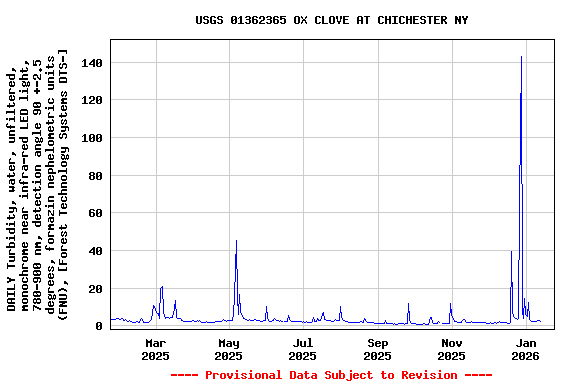
LOCATION.--Lat 42°06'42.5", long
74°18'27.6" referenced to North American Datum of
1983, Ulster County, NY, Hydrologic Unit 02020006, on left bank
0.75 mi upstream of confluence with Stony Clove Creek.
DRAINAGE AREA.--3.11 mi².
PERIOD OF RECORD1.--April 2017 to current
year.
PERIOD OF DAILY RECORD1.--TURBIDITY: April
2017 to current year.
INSTRUMENTATION1.--An optical turbidity
sensor provides readings at 15-minute intervals since April
2017.
COOPERATION1.--In cooperation with the New
York City Department of Environmental Protection.
EXTREMES FOR PERIOD OF DAILY
RECORD1.--TURBIDITY: Maximum, 1,580 FNU, Dec.
25, 2020; minimum, <0.2 FNU, Nov. 9, 2022, May 25, 2023.
[<, actual value is known to be less than the value
shown]
1 Water-Quality Records
 Site Information
 WaterAlert – get an
email or text (SMS) alert based on your chosen threshold.
 Station image