Warning: Javascript must be enabled to use all the features on this page!


Page Loading - Please Wait...

Click to hideNews Bulletins
! Daily data pages will be decommissioned in early 2026. Daily data are now available in WDFN.
Please find the modernized pages in WDFN that suit you best. Learn more about our modernization plans and timeline.

USGS 01475553 Darby Creek at 84th St Bridge at Eastwick,PA

PROVISIONAL DATA SUBJECT TO REVISION

Click to hidestation-specific text
Funding for this site is provided by:


Station gage imageSTATION.--
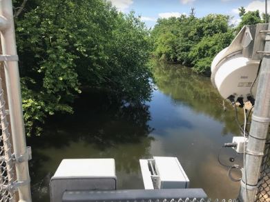
01475553 DARBY CREEK AT 84TH STREET BRIDGE AT EASTWICK, PA
LOCATION.--Lat 39`53'55", long 75`15'19", Philadelphia County, Hydrologic Unit 02040202, on 84th St. Bridge (Hook Rd.); 3.6 miles upstream from Wanamaker Rd. (SR 420), and 0.8 miles northwest from intersection of 84th St. and SR 191.
DRAINAGE AREA.--62.6 square miles.
PERIOD OF RECORD.--December 2016 to current year.
GAGE.--Water-stage recorder. Datum of gage is 0.0 ft, North American Vertical Datum of 1988.
COOPERATION.--Station established and maintained by the U.S. Geological Survey. Funding for the operation of this station is provided by the City of Philadelphia, Water Department.
REMARKS.--Satellite telemetry at station.
This station managed by the PAWSC Downingtown Field Office.

Available Parameters Period of Record
  
2016-12-14  2026-01-21


 (365)
 

  -- or --


Summary of all available data for this site
Instantaneous-data availability statement


Gage height, feet


Graph of DAILY Gage height, feet

Add up to 2 more sites and replot for "Gage height, feet"

?


Create presentation-quality graph.