Funding for this site is provided by:
 STATION.
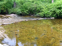
--01571184 MOUNTAIN CREEK NEAR PINE GROVE
FURNACE, PA
LOCATION.--Lat 40`01'51, long 77`18'32",
Cumberland County, Hydrologic Unit 02050305, on left bank at bridge on
Bendersville Road, 0.1 mi south of Pine Grove Furnace.
DRAINAGE AREA.--13.8 square miles.
PERIOD OF RECORD.--November 2005 to current
year.
GAGE.--Water-stage recorder and crest-stage gage.
Datum of gage is 860 ft above National Geodetic Vertical Datum of 1929,
from topographic map. Satellite telemetry at station.
COOPERATION.--Station established and maintained by
the U.S. Geological Survey. Funding for the operation of this station
is provided by the Pennsylvania Department of Conservation and Natural
Resources, Topographic and Geologic Survey.
GAGE HEIGHTS OF IMPORTANCE.-
Supplied by USGS: Data transmitter operational limit -
12.8 ft;
Supplied by NWS: No flood stage has been determined
for this station.
