Funding for this site is provided by:
 THIS SITE DOES NOT USE SATELLITE
TELEMETRY AND THEREFORE THE DATA WILL ONLY BE UPDATED ABOUT EVERY 8
WEEKS.
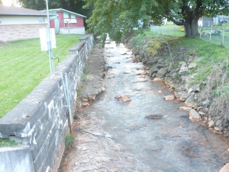
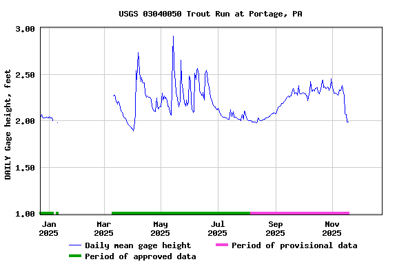
STATION.--03040050 TROUT RUN AT PORTAGE, PA
LOCATION.--Lat 40`23'08", long
78`40'33", referenced to North American Datum of 1983, Cambria
County, PA Hydrologic Unit 05010007, on right bank 30 ft upstream from
Jefferson Avenue bridge.
DRAINAGE AREA.--6.44 square miles
PERIOD OF RECORD.--June 2009 to current year
GAGE.--Water-stage recorder and crest-stage gage.
Datum of gage is 1680 ft above National Geodetic Vertical Datum of
1929, from topographic map.
COOPERATION.--Station re-established and maintained by
the U.S. Geological Survey in cooperation with the U.S. Army Corps of
Engineers, Pittsburgh District.
REMARKS.--Gage is operated as a stage-only site for
the U.S. Army Corps of Engineers (Pittsburgh District) Local Flood
Protection Project (LPP).
 THIS SITE DOES NOT USE SATELLITE
TELEMETRY AND THEREFORE THE DATA WILL ONLY BE UPDATED ABOUT EVERY 8
WEEKS.