Funding for this site is provided by:
 THIS SITE DOES NOT USE SATELLITE
TELEMETRY AND THEREFORE THE DATA WILL ONLY BE UPDATED ABOUT EVERY 8
WEEKS.
THIS SITE DOES NOT USE SATELLITE
TELEMETRY AND THEREFORE THE DATA WILL ONLY BE UPDATED ABOUT EVERY 8
WEEKS.
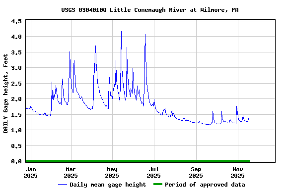
STATION.--03040100 LITTLE CONEMAUGH RIVER AT WILMORE,
PA
LOCATION.--Lat 40`23'02", long
78`43'11" referenced to North American Datum of 1927, Cambria
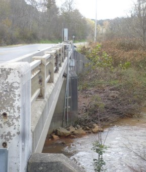
County, PA Hydrologic Unit 05010007, on left bank, upstream side of
PA-160 bridge.
DRAINAGE AREA.--49.6 sq mi
PERIOD OF RECORD.--November 2009 to current
year.
GAGE.--Water-stage recorder and crest-stage gage.
Datum of gage is 1541.4 ft above North American Vertical Datum of 1988
determined from RTN GNSS survey (Reference Frame NAD_83 (2011),
GEOID12A). Prior to November 4, 2024, the datum of gage was erroneously
reported as 1550 ft above National Geodetic Vertical Datum of
1929.
COOPERATION..--Station re-established and maintained
by the U.S. Geological Survey in cooperation with the U.S. Army Corps
of Engineers, Pittsburgh District.
REMARKS.--Gage is operated as a stage-only site for
the U.S. Army Corps of Engineers Local Flood Protection Project (LPP).