Warning: Javascript must be enabled to use all the features on this page!
Page Loading - Please Wait...
- Explore the NEW USGS National Water Dashboard interactive map to access real-time water data from over 13,500 stations nationwide.
Please find the modernized pages in WDFN that suit you best. Learn more about our modernization plans and timeline.
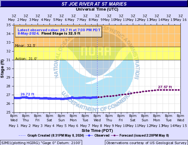
 NWS River Forecasts