LOCATION.--Lat 44° 14'53", long 111° 54'59" (NAD83), in NW1/4 SE1/4 SE1/4
sec.25, T.11 N., R.38 E., Clark County, Snowshoe Butte quad., Hydrologic Unit
17040214, at diversion structure, and 15 mi northeast of Dubois.
PERIOD OF RECORD.--April 1969 to May 1975, unpublished. Water years 1980, 1983-86,
1993, 1995, 1999, 2005, 2006 (flood season only) (discontinued).
REVISED RECORDS.--WDR-ID-85-1: Station number.
GAGE.--Water-stage recorder. Elevation of gage is 6,130 ft above NGVD of 1929,
from topographic map. Prior to June 11, 1985, at site 0.2 mi downstream at
different datum.
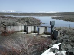
REMARKS.--Flow controlled by headgates from Camas Creek.
EXTREMES FOR PERIOD OF RECORD.--Maximum daily discharge, 730 ft3/s May 16, 1984;
no flow for long periods, when headgates are closed.