Warning: Javascript must be enabled to use all the features on this page!


Page Loading - Please Wait...

Click to hideNews Bulletins
  • Due to a lapse in government funding, the majority of USGS websites will not be updated except to provide important public safety information. Websites displaying real-time water data will be updated with limited support. For more information please see www.doi.gov/shutdown.
  • Explore the NEW USGS National Water Dashboard interactive map to access real-time water data from over 13,500 stations nationwide.
! This page is undergoing modernization and will be decommissioned in the future. Daily data are now available in WDFN.
Try it out and tell us what you think at wdfn@usgs.gov
USGS 212340157552301 3-2355-15 Kaamilo Deep, Oahu, HI

PROVISIONAL DATA SUBJECT TO REVISION

Available Parameters Period of Record
  
2004-11-11  2025-09-17
2015-04-16  2025-09-17


 (365)
 

  -- or --


Summary of all available data for this site
Instantaneous-data availability statement


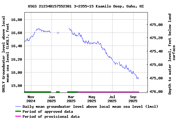
Groundwater level above local mean sea level (LMSL), feet


Graph of DAILY Groundwater level above local mean sea level (LMSL), feet

Add up to 2 more sites and replot for "Groundwater level above local mean sea level (LMSL), feet"

?


Create presentation-quality graph.  


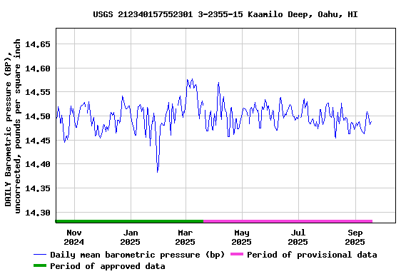
Barometric pressure (BP), uncorrected, pounds per square inch


Graph of DAILY Barometric pressure (BP), uncorrected, pounds per square inch

Add up to 2 more sites and replot for "Barometric pressure (BP), uncorrected, pounds per square inch"

?


Create presentation-quality graph.