LOCATION.--Lat 40°35'05.7", long
73°40'10.9" referenced to North American Datum of
1983, Nassau County, NY, Hydrologic Unit 02030202, at Magnolia
Boulevard, 52 ft north of West Broadway, Long Beach.
WELL CHARACTERISTICS.--Depth 1,255 ft. Upper casing
diameter 4 in; top of first opening 1,240 ft, bottom of last
opening 1,250 ft.
PERIOD OF RECORD.--November 1987, February 1988 to April
1988, March 1990 to March 1998, March 2002 to February 2010,
May 2011 to October 2012, and December 2015 to current
year.
GAGE.--Water-level recorder installed August 2002;
15-minute recording interval. Periodic manual measurements made
by USGS personnel.
REMARKS.--Water level affected by tidal fluctuation and
nearby pumping.
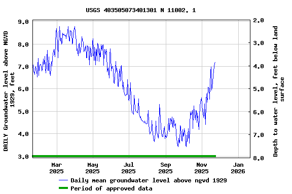
EXTREMES FOR PERIOD OF RECORD.--Highest water level
recorded, 10.00 ft above NGVD of 1929, Apr. 3, 2009; lowest
recorded, 3.3 ft below NGVD of 1929, Aug. 15, 2002.
 Site Information
 WaterAlert – get an
email or text (SMS) alert based on your chosen threshold.
WaterAlert – get an
email or text (SMS) alert based on your chosen threshold.