LOCATION.--Lat 42°38'27", long
76°03'59" referenced to North American Datum of 1983,
Cortland County, NY, Hydrologic Unit 02050102, at the Cortland
County landfill, near McGraw.
WELL CHARACTERISTICS.--Depth 37.2 ft. Upper casing
diameter 2 in; top of first opening 14.5 ft, bottom of last
opening 37.2 ft. Cased to 14.5 ft (screen 14.5 to 37.2
ft).
DATUM.--Land-surface datum is 1,863.5 ft above North
American Vertical Datum of 1988. Measuring point: Top of
shelter shelf, 3.01 ft above land-surface datum, May. 14, 2014
to Jun. 19, 2019; Top of shelter shelf, 3.02 ft above
land-surface datum, Jun. 19, 2019 to Aug. 26, 2020; Top of
shelter shelf, 3.04 ft above land-surface datum, Aug. 26, 2020
to Jun. 21, 2021; Top of shelter shelf, 3.02 ft above
land-surface datum, Jun. 21, 2021 to Aug. 2, 2022; Top of
shelter shelf, 3.04 ft above land-surface datum, Aug. 2, 2022
to Mar. 22, 2023; Top of shelter shelf, 3.02 ft above
land-surface datum, Mar. 22, 2023 to present; Top of casing,
2.9 ft above land-surface datum, Mar. 23, 2023 to present.
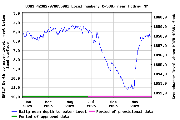
PERIOD OF RECORD.--July 2007 to current year.
GAGE.--Water-stage recorder--15 minute; periodic
measurements made by USGS personnel.
REMARKS.--Satellite water-level telemeter at
station.
EXTREMES FOR PERIOD OF RECORD.--Highest water level,
4.04 ft below land surface datum, May 14, 2019; lowest
water level, 13.32 ft below land surface datum, Oct. 16,
2020.
 Site Information
 WaterAlert – get an
email or text (SMS) alert based on your chosen threshold.
WaterAlert – get an
email or text (SMS) alert based on your chosen threshold.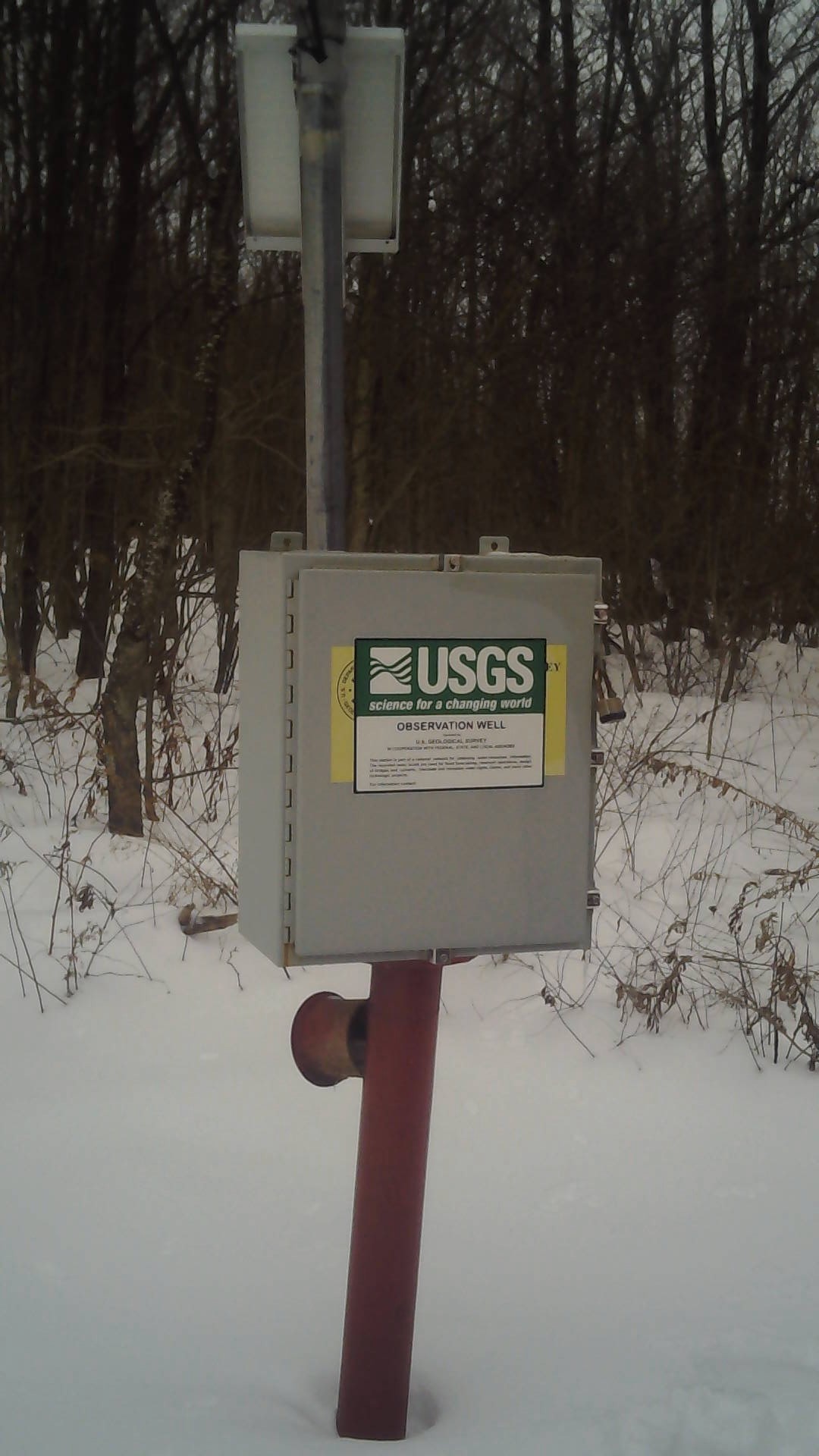 Station image