Warning: Javascript must be enabled to use all the features on this page!


Page Loading - Please Wait...

Click to hideNews Bulletins
! This page is undergoing modernization and will be decommissioned in the future. Daily data are now available in WDFN.
Try it out and tell us what you think at wdfn@usgs.gov

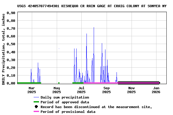
USGS 424057077494301 KESHEQUA CR RAIN GAGE AT CRAIG COLONY AT SONYEA NY

PROVISIONAL DATA SUBJECT TO REVISION

Click to hidestation-specific text


> Site Information
LOCATION.--Lat 42°40'56.9", long 77°49'43.3" referenced to North American Datum of 1983, Livingston County, NY, Hydrologic Unit 04130002, on left bank 290 feet upstream from bridge on State Highway 36, at Sonyea.
PERIOD OF RECORD (CLIM).--July 2022 to current year.
INSTRUMENTATION (CLIM).--Unshielded, 324 square centimeter collecting area, tipping bucket precipitation gage, mounted on pedestal with top of collector 7 ft above ground.
EXTREMES FOR PERIOD OF RECORD (CLIM).--Maximum daily precipitation, 2.27 inches, Nov. 11, 2023.
> Rating Information
Available Parameters Period of Record
  
2022-07-27  2025-09-05


 (365)
 

  -- or --


Summary of all available data for this site
Instantaneous-data availability statement


Precipitation, total, inches


Graph of DAILY Precipitation, total, inches

Add up to 2 more sites and replot for "Precipitation, total, inches"

?


Create presentation-quality graph.