LOCATION.--Lat 42°56'20", long
76°45'40" referenced to North American Datum of 1983,
Seneca County, NY, Hydrologic Unit 04140201, on right bank, 30
ft upstream from bridge on State Highway 89, 1.1 mi upstream
from Cayuga Lake, and about 2.5 mi downstream from Lock 2 of
the Cayuga-Seneca Canal in Seneca Falls.
DRAINAGE AREA.--785 mi².
PERIOD OF RECORD.--October 2005 to current year.
GAGE.--Acoustic velocity meter and water-stage recorder.
Datum of gage is 376.81 ft above NGVD of 1929 and 376.25 ft
above NAVD of 1988. Prior to Apr. 1, 2019, datum of gage was
NGVD of 1929.
REMARKS.--Flow regulated by Cayuga-Seneca Canal Locks 2
and 3, and Seneca Falls Power Project. Flow affected by
backwater from Cayuga Lake.
Water Years 2014-24: Records good except estimated daily
discharges, which are fair.
EXTREMES FOR PERIOD OF RECORD.--Maximum daily discharge,
3,290 ft³/s, May 4, 2011; maximum gage height, 7.95 ft, May 1,
2011, present datum; minimum daily discharge, -23.9
ft³/s, Feb. 21, 2021. Maximum and minimum instantaneous
discharges not determined.
 Site Information
 WaterAlert – get an
email or text (SMS) alert based on your chosen threshold.
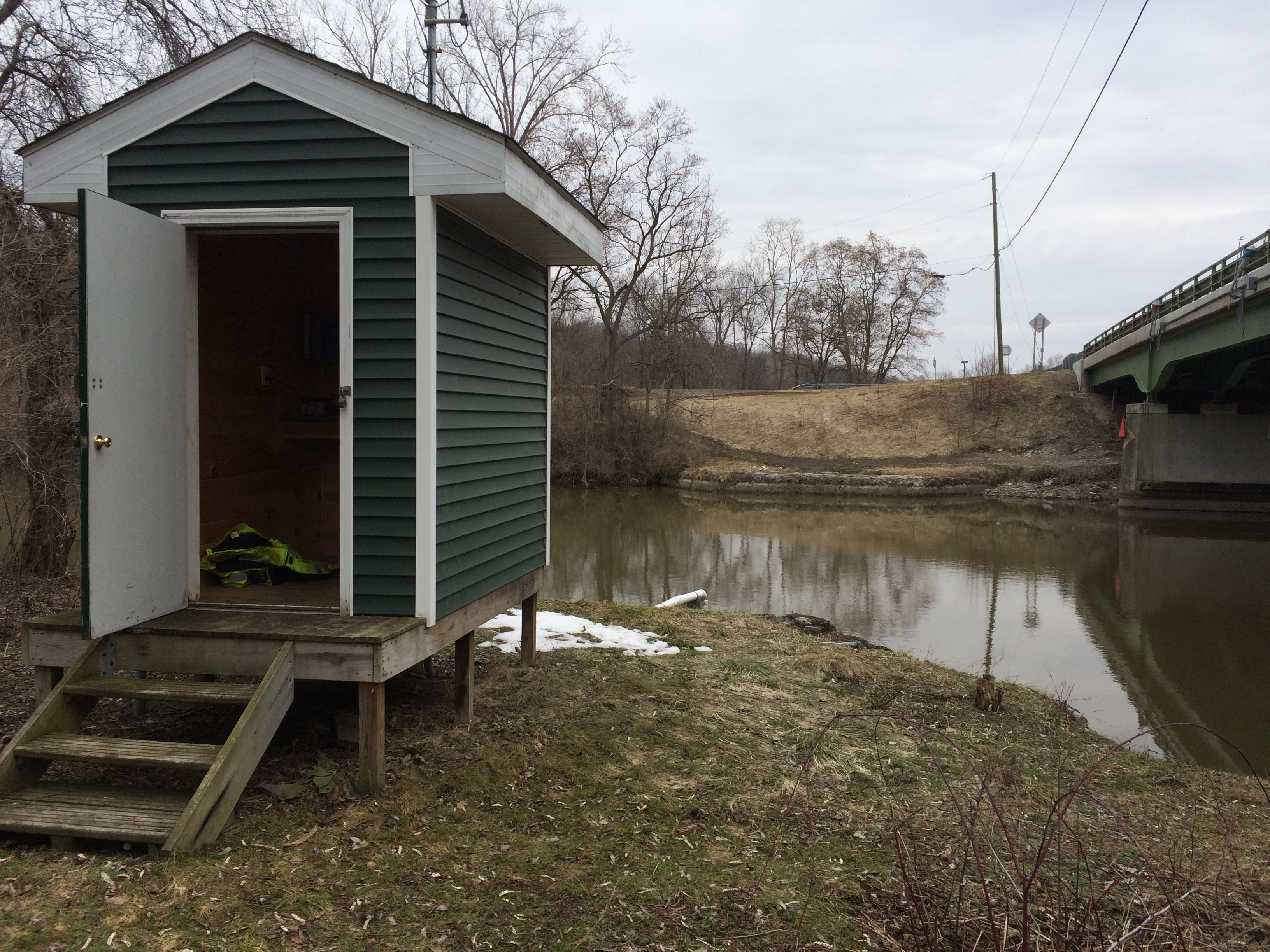
 Station image
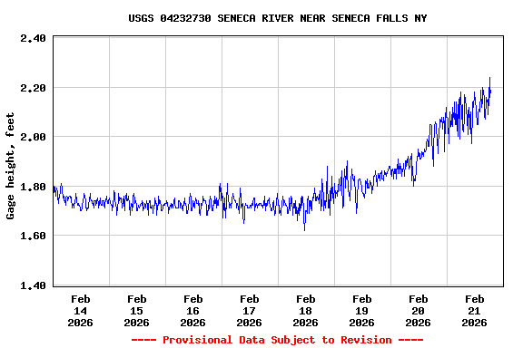
![Graph of Discharge, cubic feet per second, [Primary Discharge]](https://natwebcaww01.wr.usgs.gov/nwisweb/data/img/USGS.04232730.107643.00060..20260214.20260221.log.0.p50.gif)


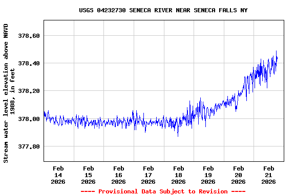
![Graph of Mean water velocity for discharge computation, feet per second, [SL Mean Water Velocity]](https://natwebcaww01.wr.usgs.gov/nwisweb/data/img/USGS.04232730.249701.72255..20260214.20260221..0..gif)