LOCATION.--Lat 43°42'45.6", long
74°58'09.7" referenced to North American Datum of
1983, Herkimer County, NY, Hydrologic Unit 04150101, at dam on
Middle Branch Moose River, 100 ft upstream from bridge on State
Highway 28 at Old Forge, and 11.2 mi downstream from dam on
Sixth Lake outlet at Inlet.
DRAINAGE AREA.--53.6 mi².
PERIOD OF RECORD.--October 1969 to September 2003
(month-end elevations or gage heights, and contents). October
2003 to current year. Prior to October 1971, published as
"Old Forge Reservoir". Records from November 1911 to
September 1969, available from Board of Hudson River-Black
River Regulating District.
REVISIONS HISTORY.--WDR NY-85-1: Drainage area.
GAGE.--Water-stage recorder and nonrecording gage read
once daily. Datum of gage is NGVD of 1929 (levels by Board of
Hudson River-Black River Regulating District). To convert
elevations to NAVD of 1988, add 0.07 ft. Prior to 2004 water
year, only nonrecording gage read once daily.
COOPERATION.--Elevation record and capacity table (1959)
provided by Board of Hudson River-Black River Regulating
District.
REMARKS.--The First through Fifth Lakes of Fulton Chain
Lakes are partially formed and controlled by a concrete dam
with 12-inch flashboards. Storage began around 1881 or 1882
with a wooden crib dam. This dam was replaced with a concrete
dam in 1905 and gates were installed in 1927. Usable capacity,
895.6 mil ft³ between minimum operating level, elevation
1,696.8 ft, and crest of spillway with flashboards, elevation
1,707.04 ft. Usable capacity without flashboards, 764.3 mil
ft³, elevation 1,706.06 ft; no dead storage below minimum
operating level. Figures given herein represent usable
contents. The dam is operated by Board of Hudson River-Black
River Regulating District.
Capacity table (elevation, in feet, and usable contents, in millions of cubic feet)

Elevation  Contents      Elevation  Contents
1,699.4       0.5        1,704.0     498.0
1,700.0      21.0        1,706.0     756.5
1,702.0     252.0        1,707.9   1,015.0
EXTREMES FOR PERIOD OF RECORD.--Maximum elevation
observed, 1,707.93 ft, June 17, 1972, contents, 1,019 mil ft³;
minimum elevation observed, 1,699.8 ft, Nov. 3, 1939, contents,
6.50 mil ft³.
 Site Information
 WaterAlert – get an
email or text (SMS) alert based on your chosen threshold.
WaterAlert – get an
email or text (SMS) alert based on your chosen threshold.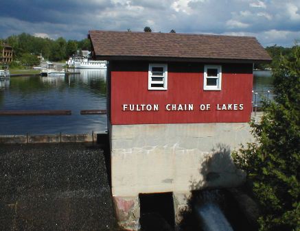 Station image