Warning: Javascript must be enabled to use all the features on this page!


Page Loading - Please Wait...

* We've detected you're using a mobile device. Find our Next Generation Station Page here.
Click to hideNews Bulletins
! This page is undergoing modernization with expected decommissioning as key features are added to the modernized pages.
Learn more about our modernization plans to find out which options will suit you best. Next Generation Monitoring Location Page is available now.

USGS 06327500 Yellowstone River at Glendive, MT

PROVISIONAL DATA SUBJECT TO REVISION

Click to hidestation-specific text
Flood Tracking - Stage Flood Tracking - Discharge Gage-height Corrections Base Rating Shifted Rating
(About shift-adjusted ratings).
Station operated by the USGS Wyoming-Montana Water Science Center as part of the Federal Priority Streamgages network.
Leaving USGS: National Weather Service forecast. U.S. Coast Guard boating safety tips.
This station managed by the Billings Field Unit.

Available Parameters Available Period
  
2002-11-24  2024-06-28
2007-10-01  2024-06-28


 (7)
 

  -- or --


Summary of all available data for this site
Instantaneous-data availability statement


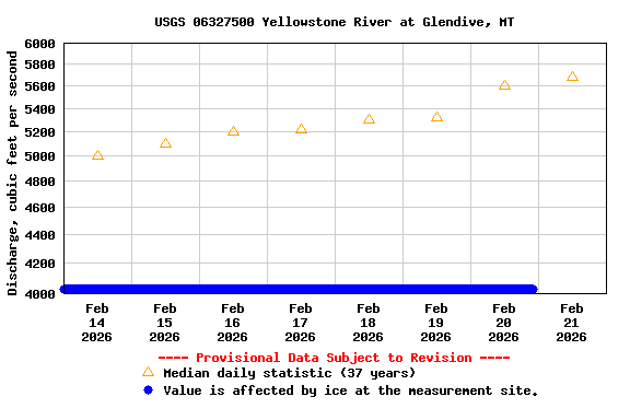
Discharge, cubic feet per second

Most recent instantaneous value: 22500 06-28-2024   17:30 MDT
Graph of  Discharge, cubic feet per second

Add up to 2 more sites and replot for "Discharge, cubic feet per second"

?


Create presentation-quality / stand-alone graph.   Subscribe to WaterAlert      

See this graph on the Monitoring Location Pages


Daily discharge, cubic feet per second -- statistics for Jun 28 based on 37 water years of record more
Min
(1934)
Most Recent
Instantaneous
Value Jun 28
25th
percen-
tile
Mean Median 75th
percen-
tile
Max
(2011)
9040 22500 23600 39100 40400 52300 79600


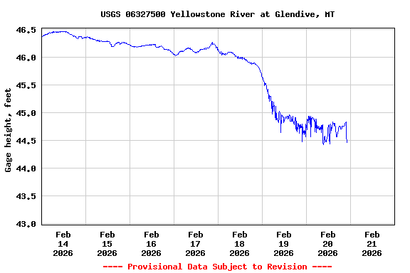
Gage height, feet

Most recent instantaneous value: 46.28 06-28-2024   17:30 MDT
Graph of  Gage height, feet

Add up to 2 more sites and replot for "Gage height, feet"

?


Create presentation-quality / stand-alone graph.   Subscribe to WaterAlert      

See this graph on the Monitoring Location Pages