Warning: Javascript must be enabled to use all the features on this page!


Page Loading - Please Wait...

Click to hideNews Bulletins
! This page is undergoing modernization with expected decommissioning as key features are added to the modernized pages.
Learn more about our modernization plans to find out which options will suit you best. Next Generation Monitoring Location Page is available now.
A beta version of the My Favorites page is available in WDFN. Try it out and tell us what you think at wdfn@usgs.gov
Boating safety tips are available from the U.S. Coast Guard.

NOTE: During cold periods, gage height and streamflow information may be adversely affected by ice.


USGS 06934500 Missouri River at Hermann, MO

PROVISIONAL DATA SUBJECT TO REVISION

Click to hidestation-specific text

Logo for USACE Station operated in cooperation with the  U.S. Army Corps of Engineers—Kansas City District,  and


Logo for U.S. Geological Survey National Streamflow Information Program


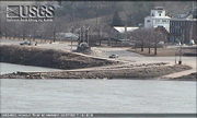
Link to web cam at Hermann, MOThe WebCam at Hermann, MO updates every hour.


The precipitation data for this station are temporary and will only be displayed for 120 days. Time series of cumulative daily values will NOT be available for retrieval following the 120-day display period. Although the instrumentation is calibrated at least once/year, the temporary classification means that documented routine inspections and other quality assurance measures are not performed that would make the data acceptable forarchival, retrieval, or future use in general scientific or interpretive studies.


Logo for NOAA, National Weather Service National Weather Service River Forecast


Logo for Rating Current stage-discharge rating


This station managed by the Rolla Field Office.

Available Parameters Available Period
  
2007-10-01  2025-02-03
1987-10-01  2025-02-03
2007-10-01  2025-02-03
2007-10-01  2025-02-03
2007-10-01  2025-02-03
2022-02-03  2025-02-03
2007-10-01  2025-02-03
2016-08-16  2025-02-03
2022-02-22  2023-08-03
2022-02-03  2023-08-03
2007-10-01  2025-02-03
2015-03-25  2025-02-03
2007-10-01  2025-02-03


 (7)
 

  -- or --


Summary of all available data for this site
Instantaneous-data availability statement

Temperature, water, degrees Celsius
 
-- Data temporarily unavailable for the time period specified --


Discharge, cubic feet per second

Most recent instantaneous value: 46000 02-03-2025   15:30 CST
Graph of  Discharge, cubic feet per second

Add up to 2 more sites and replot for "Discharge, cubic feet per second"

?


Create presentation-quality / stand-alone graph.   Subscribe to WaterAlert      

See this graph on the Monitoring Location Pages


Daily discharge, cubic feet per second -- statistics for Feb 3 based on 67 water years of record more
Min
(1961)
25th
percen-
tile
Most Recent
Instantaneous
Value Feb 3
Median Mean 75th
percen-
tile
Max
(1973)
12800 33500 46000 51900 63300 89300 189000


Gage height, feet

Most recent instantaneous value: 4.33 02-03-2025   15:30 CST
Graph of  Gage height, feet

Add up to 2 more sites and replot for "Gage height, feet"

?


Create presentation-quality / stand-alone graph.   Subscribe to WaterAlert      

See this graph on the Monitoring Location Pages


Specific conductance, water, unfiltered, microsiemens per centimeter at 25 degrees Celsius
 
-- Data temporarily unavailable for the time period specified --

Dissolved oxygen, water, unfiltered, milligrams per liter
 
-- Data temporarily unavailable for the time period specified --


Dissolved oxygen, water, unfiltered, percent of saturation

Most recent instantaneous value: 93 02-03-2025   16:15 CST
Graph of  Dissolved oxygen, water, unfiltered, percent of saturation

Add up to 2 more sites and replot for "Dissolved oxygen, water, unfiltered, percent of saturation"

?


Create presentation-quality / stand-alone graph.   Subscribe to WaterAlert      

See this graph on the Monitoring Location Pages


pH, water, unfiltered, field, standard units
 
-- Data temporarily unavailable for the time period specified --

Dissolved organic matter fluorescence (fDOM), water, in situ, concentration estimated from reference material, micrograms per liter as quinine sulfate equivalents (QSE)
 
-- Data temporarily unavailable for the time period specified --

Turbidity, water, unfiltered, monochrome near infra-red LED light, 780-900 nm, detection angle 90 +-2.5 degrees, formazin nephelometric units (FNU)
 
-- Data temporarily unavailable for the time period specified --

Nitrate plus nitrite, water, in situ, milligrams per liter as nitrogen
 
-- Data temporarily unavailable for the time period specified --


Phosphorus, water, unfiltered, estimated by regression equation, milligrams per liter as phosphorus

Most recent instantaneous value: 0.46 02-03-2025   16:15 CST
Graph of  Phosphorus, water, unfiltered, estimated by regression equation, milligrams per liter as phosphorus

Add up to 2 more sites and replot for "Phosphorus, water, unfiltered, estimated by regression equation, milligrams per liter as phosphorus"

?


Create presentation-quality / stand-alone graph.   Subscribe to WaterAlert      

See this graph on the Monitoring Location Pages